


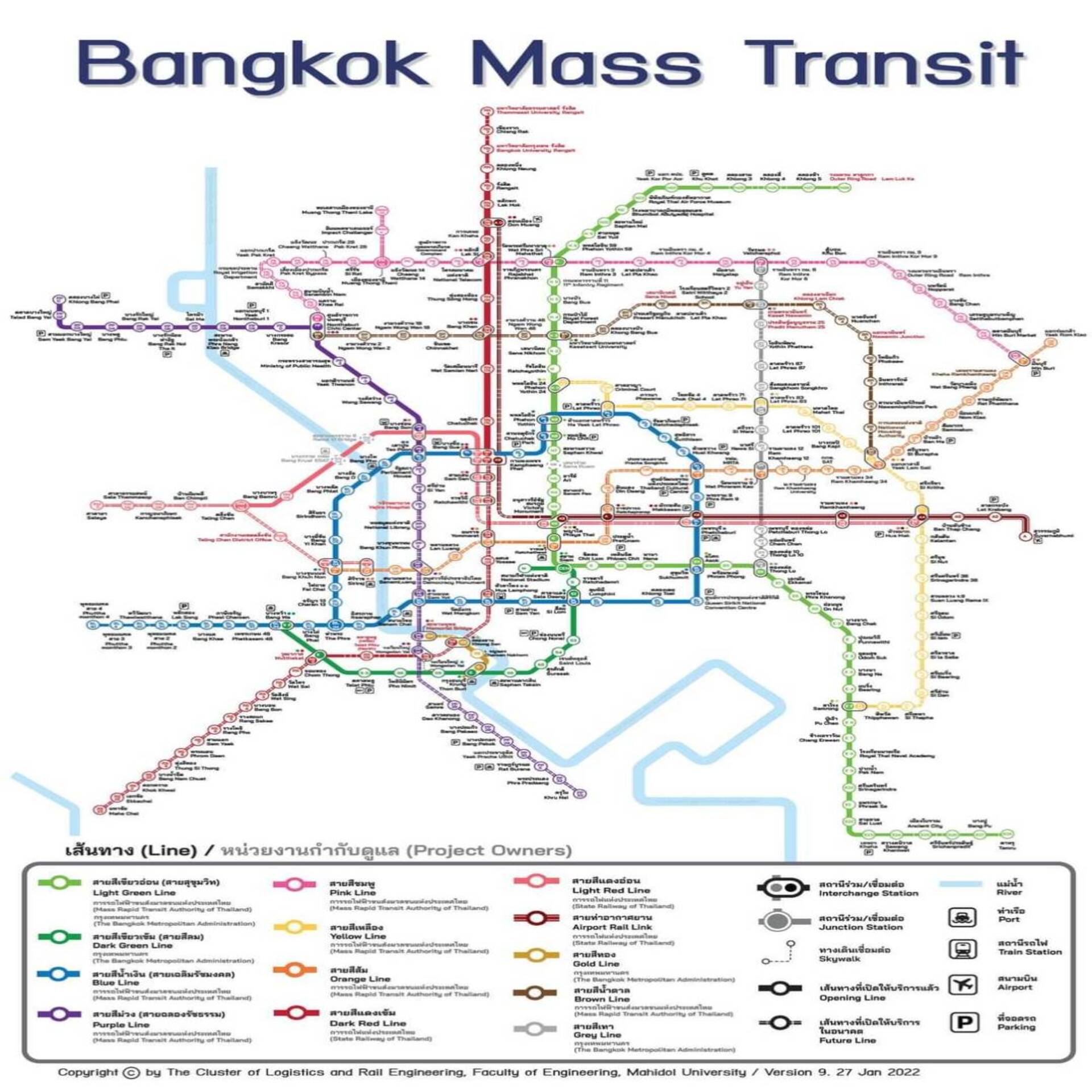
The Department of Rail Transport, in collaboration with the Faculty of Engineering at Mahidol University, has produced a map of the electric train routes currently in operation (11 lines, total distance of 211.94 kilometers, 141 stations). The routes are color-coded and station names are clearly and comprehensively indicated as currently in use. The details are as follows:
- Mo Chit – Samut Prakan (Light Green) (37.10 kilometers)
- Mo Chit – Saphan Mai – Khu Khot (Light Green) (18.70 kilometers)
- National Stadium – Bang Wa (Dark Green) (14 kilometers)
- Bang Sue – Hua Lamphong (Blue) (20 kilometers)
- Bang Sue – Tha Phra (Blue) (13 kilometers)
- Hua Lamphong – Bang Khae (Blue) (14 kilometers)
- Bang Yai – Tao Poon (Purple) (23 kilometers)
- Bang Sue – Rangsit (Dark Red) (26.30 kilometers)
- Bang Sue – Taling Chan (Light Red) (15.26 kilometers)
- Krung Thon Buri – Khlong San (Gold) (1.88 kilometers)
- ARL Phaya Thai – Suvarnabhumi (Airport Line) (28.70 kilometers)
Additionally, a complete map of all electric train routes (14 lines, total distance of 553.41 kilometers, 367 stations) is available for download in large size at https://www.mrta.co.th/th/brochures-and-videos/265.
For more information:
📞 02-015-1919 ext. 2, Membership Department
📱 Line Official: @cwc.telesale
💻 Website: www.cwc.co.th